
What is it like to hike to Slåttdalsskrevan in the High Coast? We recently hiked to this spectacular place and we were some of the last to go. through crevice. The passage is now closed for safety reasons, but you can still hike to Slåttdalsskrevan and see its dramatic shapes. You can also still see the fantastic views from the top of the mountain.
 Tweet
Tweet Share
Share Share
Share Pin
Pin Share
Share Share
ShareTable of contents
The Slåttdal crevice in the High Coast
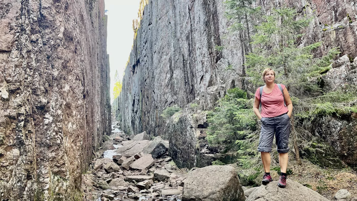
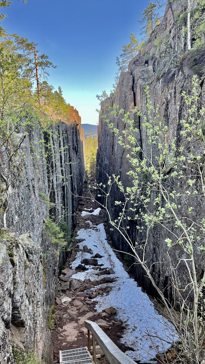
Slåttdalsskrevan is an approximately 200 metre long, 30 metre deep and seven metre wide rift that splits Slåttdalsberget, in the High Coast, into two parts.
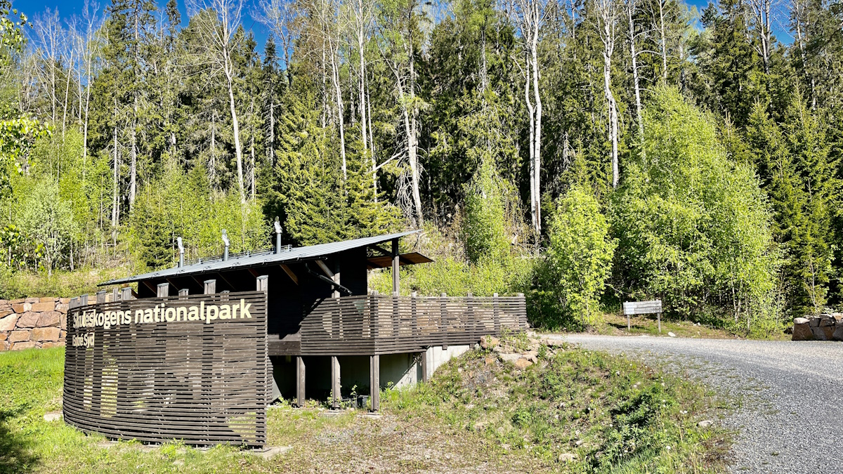
Slåttdalsskrevan is located in Skuleskogen National Park in Ångermanland.
Start at Entrance South in Skuleskogen National Park.
The shortest way to hike to Slåttdalsskrevan is from Entré Syd, and we chose this route. Other options are to hike from Entré Nord or from Entré Väst, and some believe that the latter of these offers the most beautiful trail. Another option, for the hiker, is to walk the entire Höga kusten trail, passing the crevice during one stage.
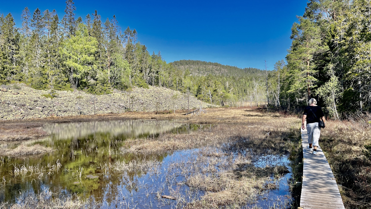
We drove to the southern entrance with the motorhome, where there are toilets and information signs. Here we parked and then followed the signs, with orange markings, into the forest.
Hiking to Slåttdalsskrevan
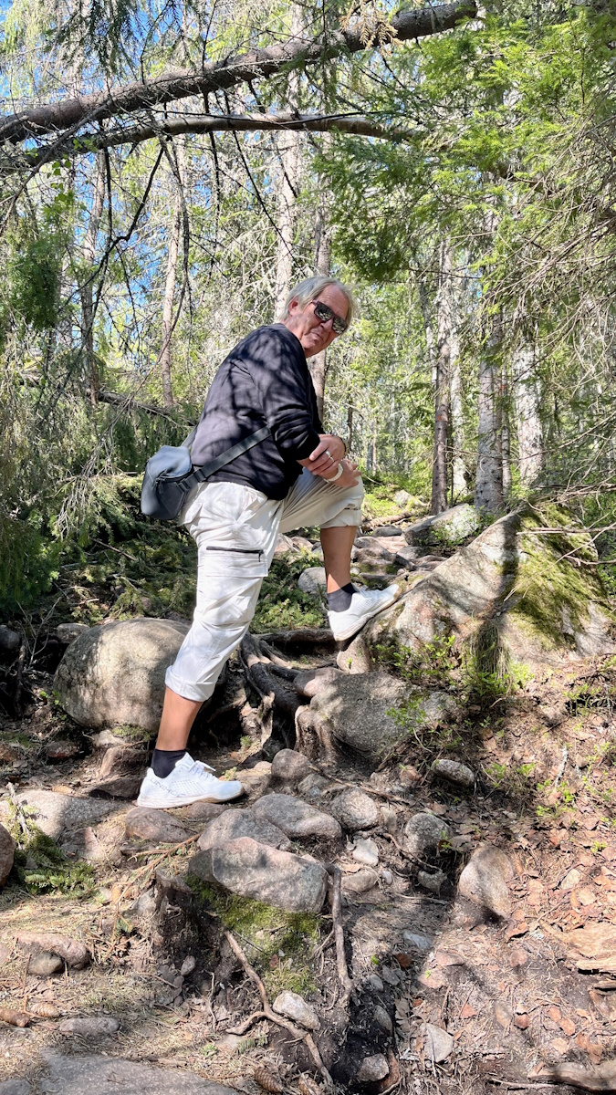
The hike to Slåttdalsskrevan, from Entré Syd, is nice and suitable for many. On large parts of the trail they have laid out wooden footbridges, which makes it relatively easy to walk. Large parts of the hike are also on reasonably flat terrain or slightly uphill.
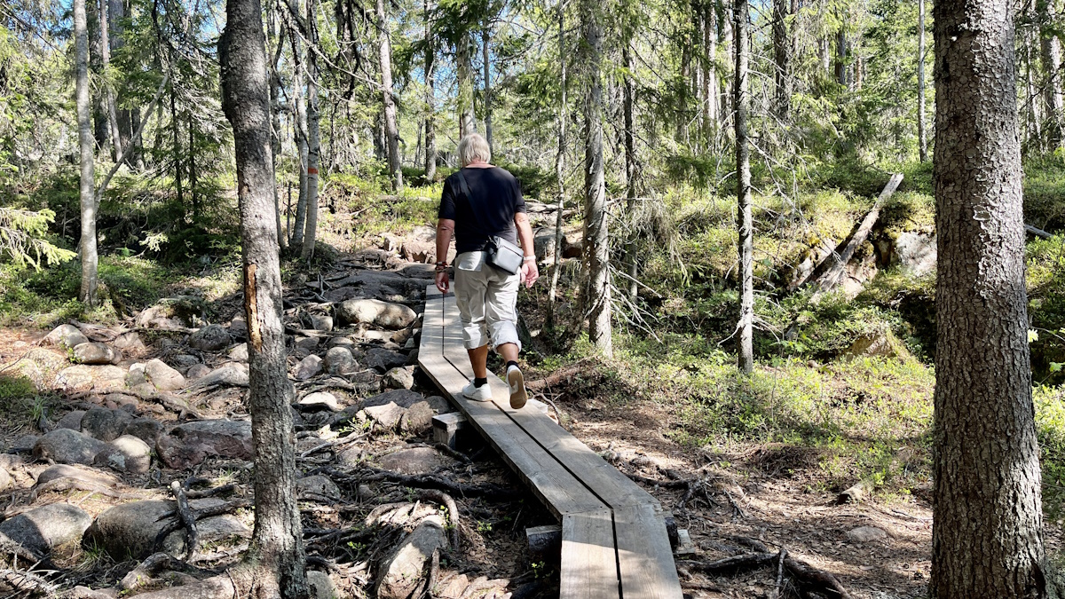
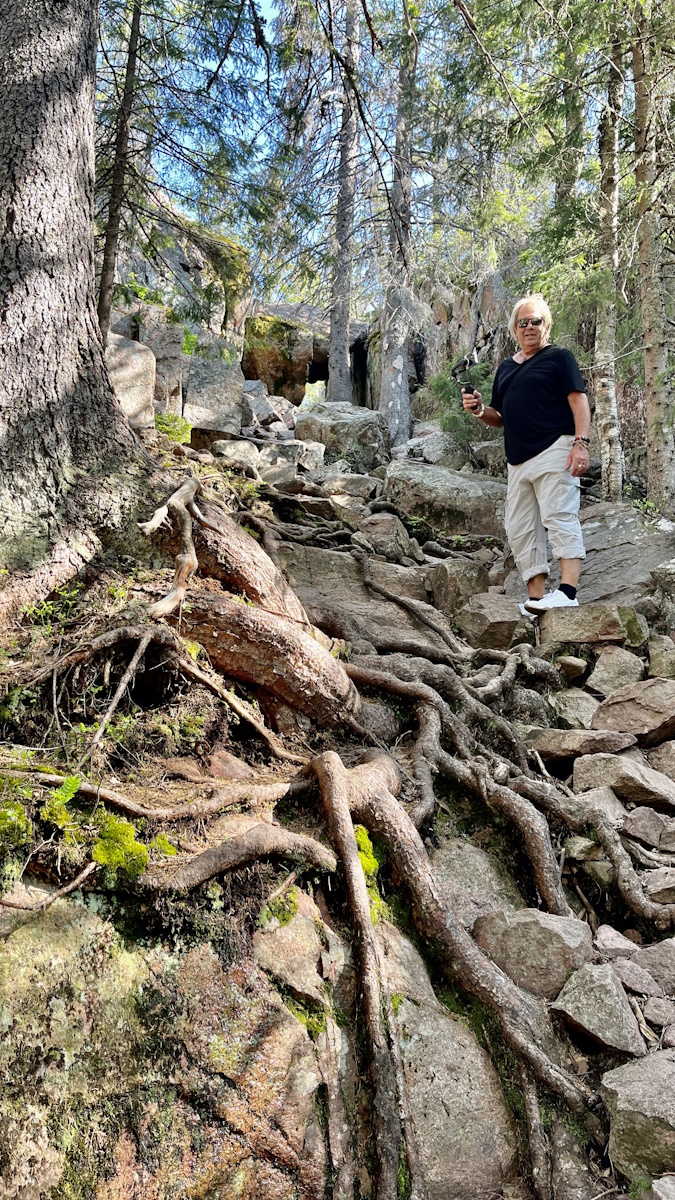
However, in some places it is much steeper, with lots of rocks and roots. It takes longer to get there ...
The hike one way is, according to the sign at Entré Syd, 3.1 kilometres. If you, like us, choose to walk up to the top of Slåttsdalsberget, the total length will be a little more than double this. We definitely recommend taking good shoes and water, and perhaps a packed lunch or some snacks.
A smaller crevice - before the Slåttdalsskrevan crevice
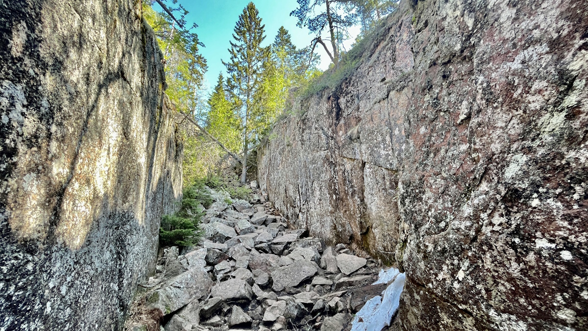
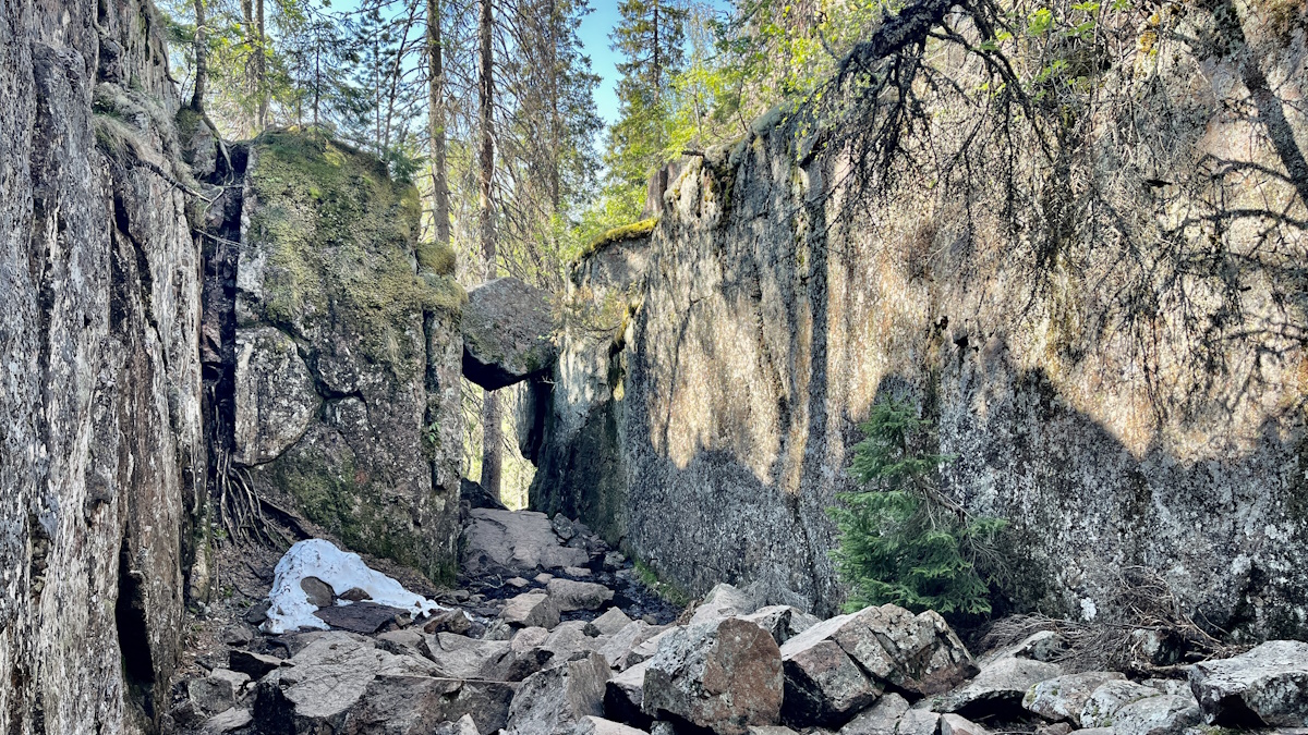
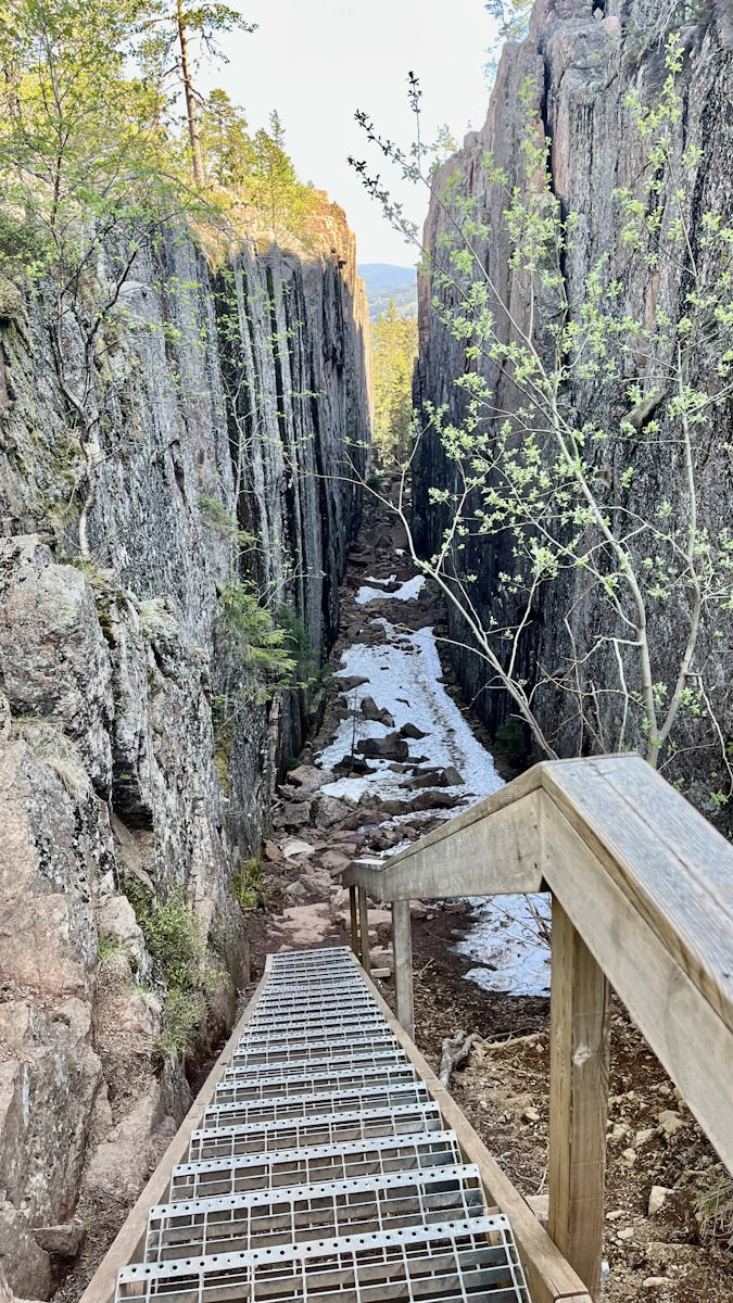
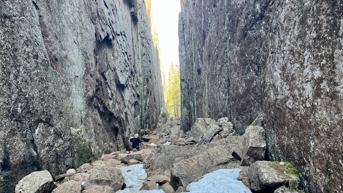
Just before you approach Slåttdalsskrevan, it starts to get really steep, and the landscape offers exciting surprises. You enter through a small "gate" with a large boulder hanging above the entrance.
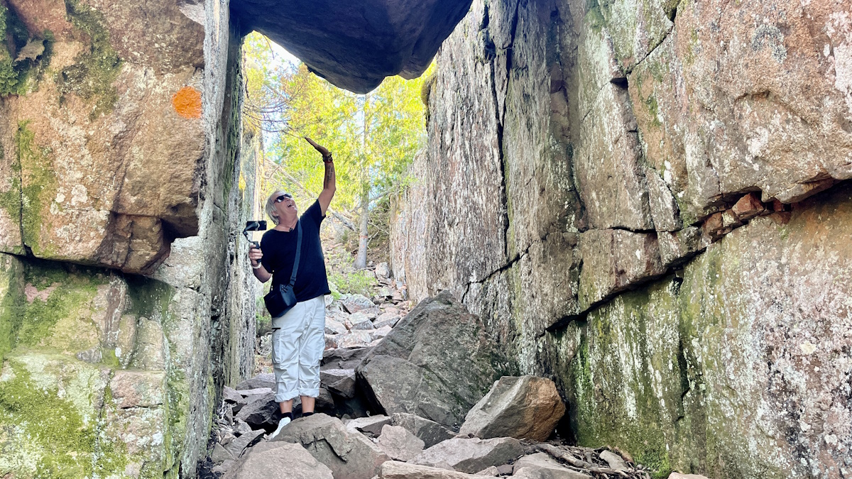
As you pass through the gate, you enter a smaller crevice, which looks like a mini version of Slåttdalsskrevan. We were told that some people think this is the "real" crevice and turn around here. In other words, don't do it! Once you've passed through this smaller crevice, you come to a natural phenomenon that actually takes your breath away...
Arriving at Slåttdalsskrevan
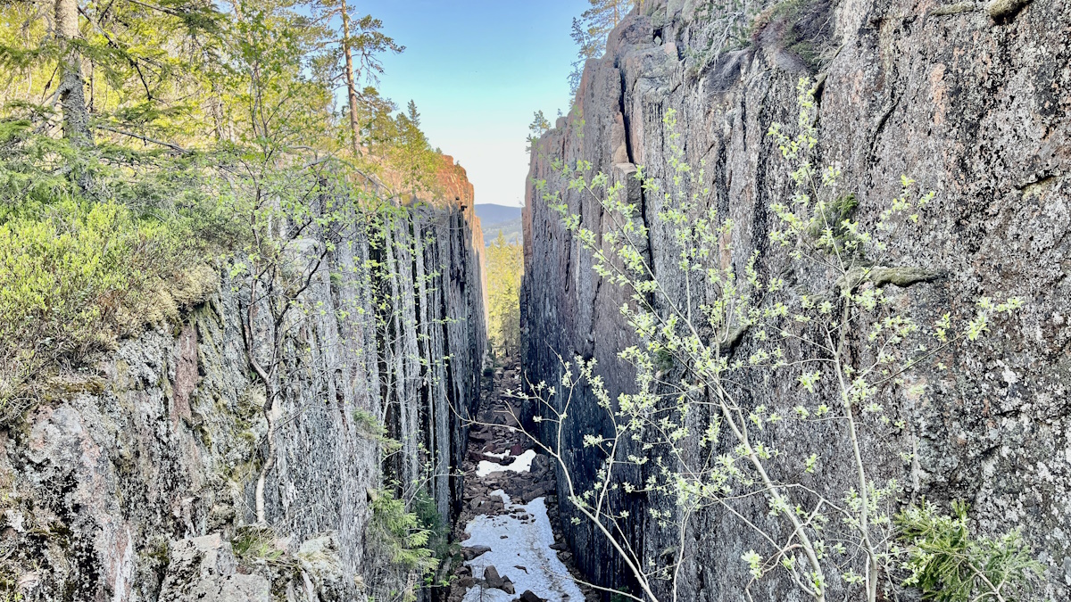
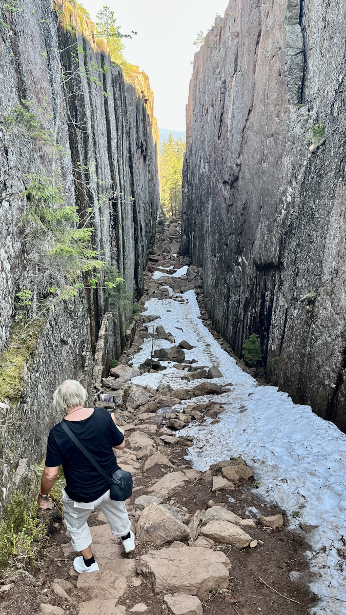
It doesn't matter that you have seen Slåttdalsskrevan in pictures before. Seeing it in real life is something else entirely. The walls are vertical and dramatically high, and the chasm looks like something out of a fantasy film. The film Ronja Rövardotter also comes to mind, although as far as we know it was not filmed here at all.

The explanation for the crack is that sometime around 1,200 million years ago, magma erupted from underground and created a diabase vein. This diabase weathered more easily than the hard Nordin grey granite that makes up the mountain, and over time a deep fissure was formed.
Hiking through Slåttdalsskrevan - no longer possible
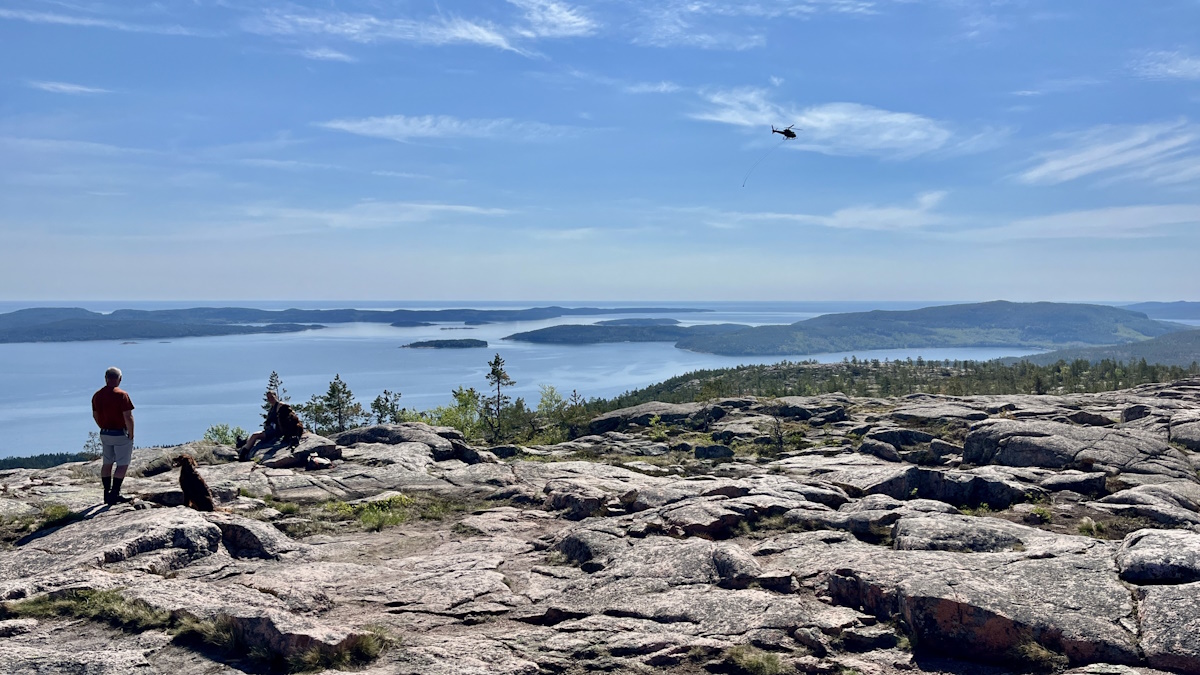
When we arrived at Slåttdalsskrevan, a helicopter hovered above us. A man on the ground, who worked for Skuleskogen National Park, informed us of what was happening. Slåttdalsskrevan would be closed. Forever. They were now transporting materials to reroute the hiking trail.
The reason for the closure is that the safety of tourists cannot be guaranteed. Rocks, boulders and ice can fall from the cliffs, and even though they spend a lot of money every year to clear them, they don't dare continue to let tourists in. From now on, you arrive at the entrance of the groin - where you have full visibility - and then you have to follow the orange trail to the left.
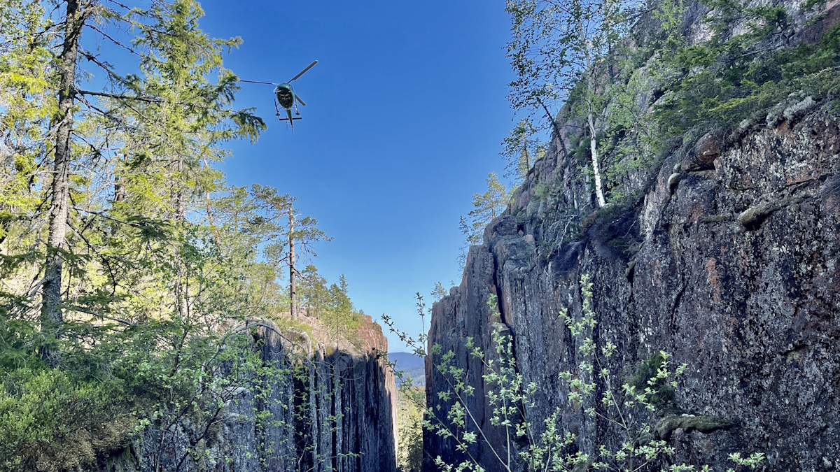
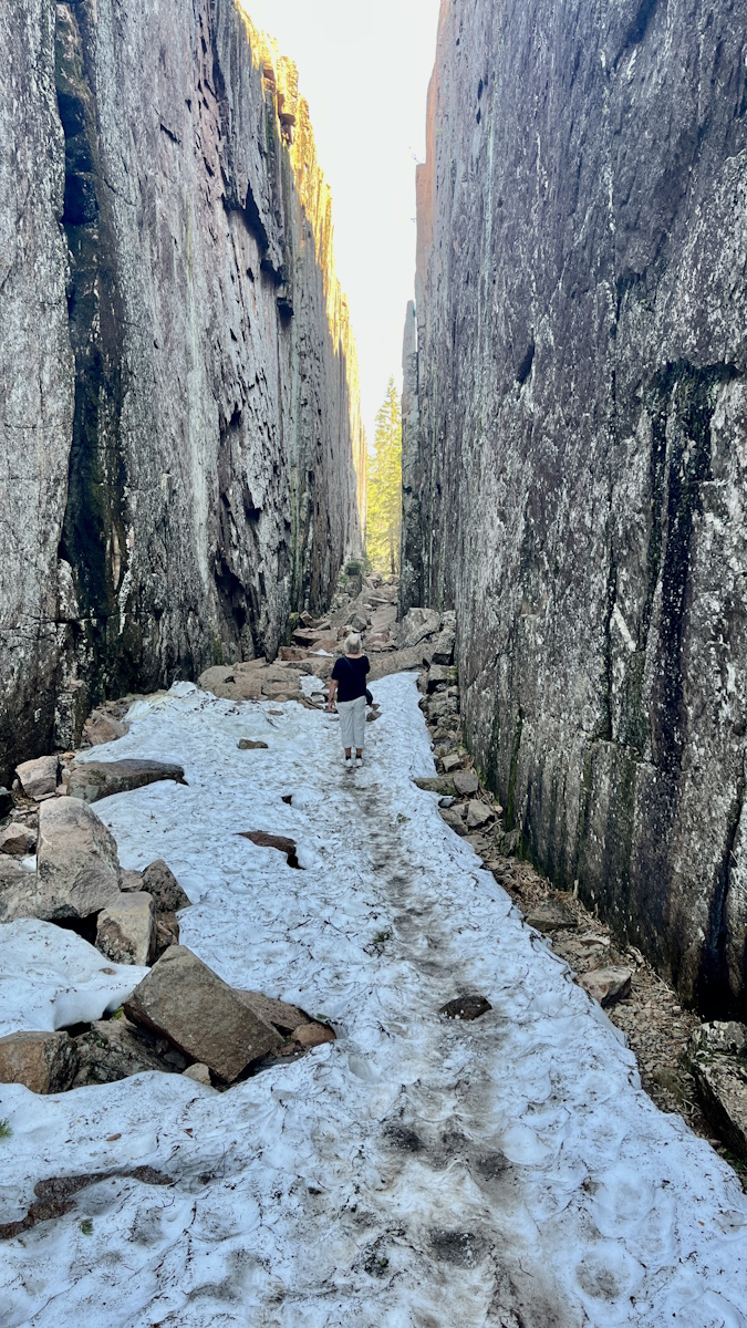
But could we pass through Slåttdalsskrevan then? Yes, we could. It stayed open for a few more days and we were welcomed through, at our own risk. "Feel free to walk close to the high mountain edge. Keep your distance. Do not talk. Do not stop." That was the advice.
The slope was both rocky and snowy, so it took a while to get through. But it was delicious!
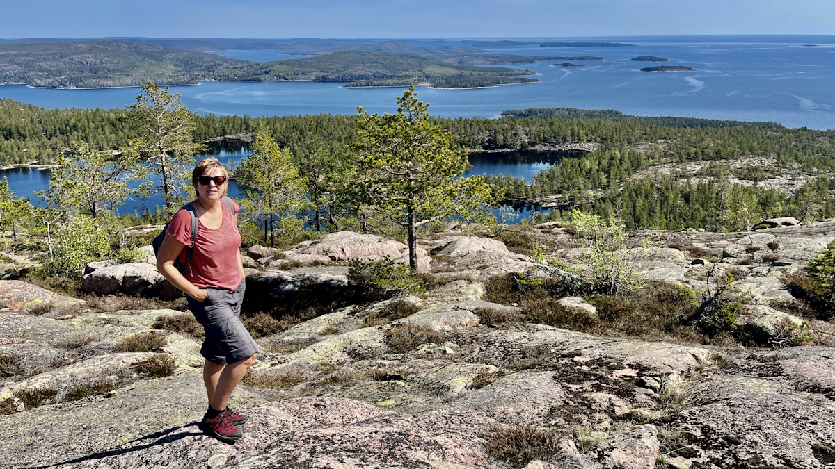
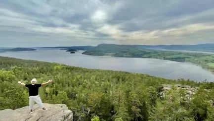
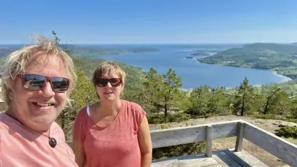
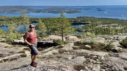
View from the top of the mountain
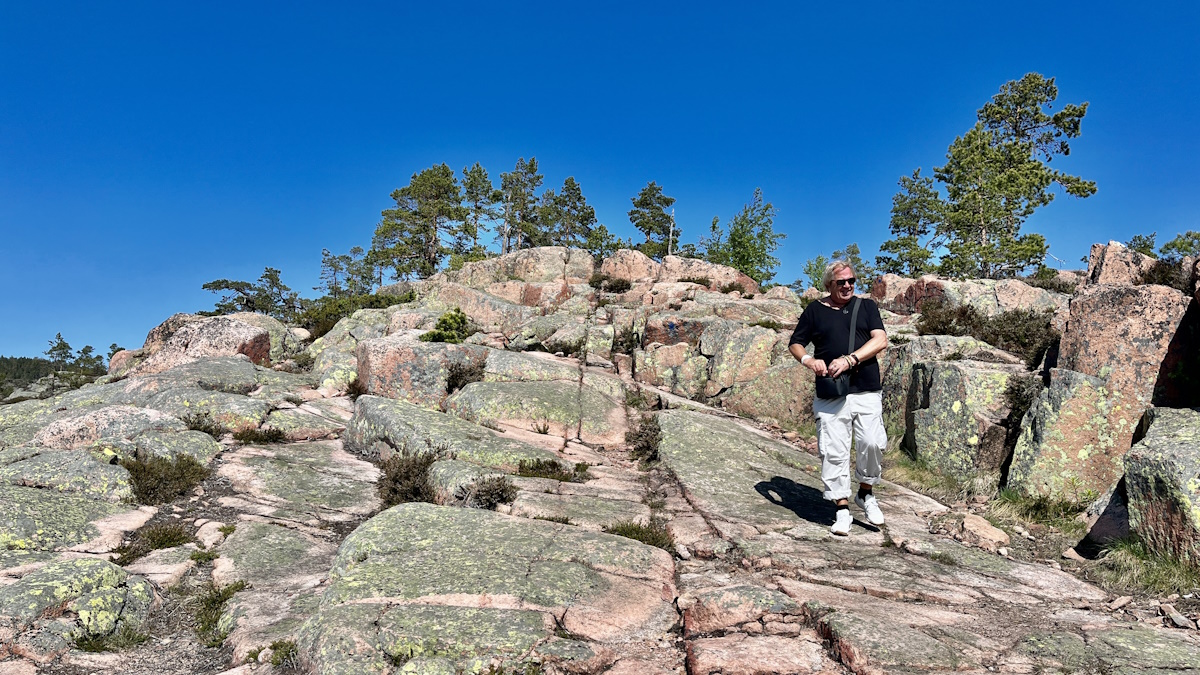
It is not only the hike to Slåttdalsskrevan that is an experience. The view from the top of Slåttdalsberget, towards the sea, is... least equally fascinating. We went up the mountain on the right, after crossing the crevasse. If you want to see the same view, make sure to go up the mountain, after passing the lower part of the crevice.
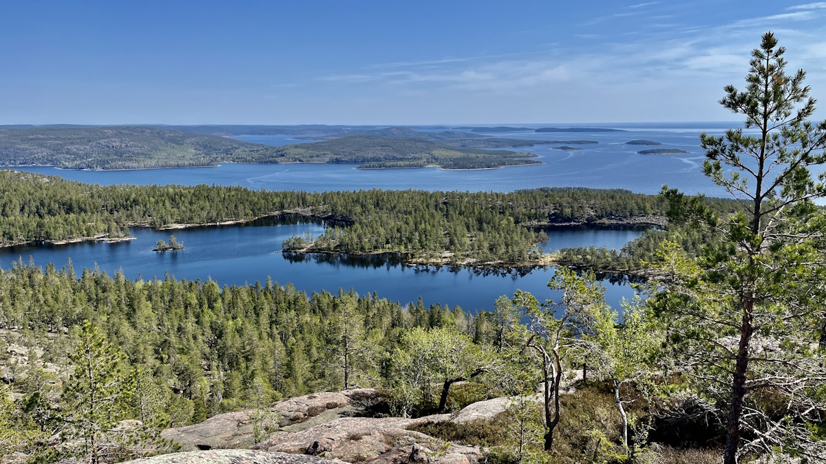
The view from the top of Slåttdalsberget is fantastic. Up here you are like "above everything" and you can see in all directions. We ate our packed lunch up here, and we really couldn't get enough of the views.
A little further down the mountain we met two other couples, also hiking in Skuleskogen National Park. Together we looked out into the distance, talking nonsense and watching the helicopter rushing back and forth with building materials.
Hiking back from Slåttdalsskrevan
When you are on top of Slåttdalsberget, you can follow the blue trail down, back towards Entré Syd.
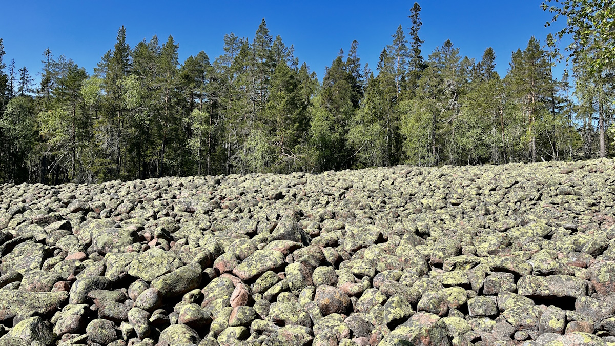
The walk down is a bit steep in some places, but mostly relatively easy. We also walked past large pebble fields, before getting back onto the orange trail, which led us back.
Where can you stay or park your motorhome?
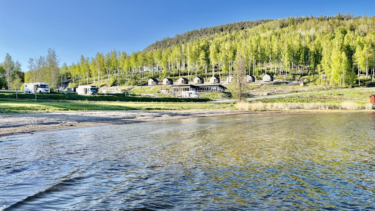
So, where can you stay or park your motorhome when visiting Slåttdalsskrevan? There are of course many different places to choose from, but we can recommend Skulebergets Havscamping, where there are both cabins and pitches for motorhomes/caravans.
The campsite is just eight kilometres from Entré Syd. So you can easily take your bike (note the hills!), electric bike, motorhome or car from here. Another popular campsite in the neighbourhood is Friluftsbyn, with both cabins and campsites.
More to see and do in the neighbourhood
In the neighbourhood of Slåttdelsskrevan there are several other cool nature experiences. We can recommend a trip up the Mount Skule and a hike up to the The pulpit on Mount Getsvedje. Other nice places in the area include Ulvön, Norrfällsviken and memories of man in Nordingrå. Please also read all our tips on things to What to see and do in the High Coast.
Have you hiked to Slåttdalsskrevan?
This hike was fantastic, we thought! Have you hiked to Slåttdalsskrevan? Which way did you go? How was your experience? Please tell us!
Frequently asked questions about Slåttdalsskrevan
How long does it take to walk to Slåttdalsskrevan?
It takes different amounts of time to walk to Slåttdalsskrevan, depending on which entrance you start at. The shortest route is from Entrance South, from where it may take about 45 minutes to arrive, one way.
Is it safe to visit Slåttdalsskrevan?
Slåttdalsskrevan has recently been closed off, as safety cannot be guaranteed when passing through it. Hiking around it is no problem. However, you also have to be careful if you walk along the edges of the crevice, as there are steep cliffs.
Is it worth hiking to Slåttdalsskrevan now that it is closed?
Slåttdalsskrevan is closed for hiking through, but you can still look in from the short sides, which offers the very best views. There are also fantastic views from Slåttsdalsberget.
Facts about Slåttdalsskrevan in the High Coast region
- Landscape: Ångermanland
- Location: Slåttdalsberget in Skuleskogen National Park, on the High Coast.
- Name: Slåttdalsskrevan (alternative spelling: Slåtterdalsskrevan)
- Length: 200 metres
- Depth: 30 metres
- Width: 7 metres
- Rock type: Red Nordic grey granite
- Formation: 1,200 million years ago, magma erupted from underground and formed a diabase flow, which has since been eroded away.
- Read more: You can find more information at Sweden's national parks.
Hiking to Slåttdalsskrevan
- From Entrance South: 3.6 kilometres one way. Partly steep and rocky. Can be crowded on car parks and trails in summer.
- From Entrance West: 6 kilometres one way. Great views along the way.
- From Entré Nord: 4.5 kilometres one way. Partly steep and rocky.
- The High Coast Trail: The trail starts at Hornöberget and the final destination is Örnsköldsvik. The trail is 128 kilometres long, divided into 13 stages. Stage 9 of this trail runs from Entré Syd to Entré Nord, past Slåttdalsskrevan.
You might also like:
 The pulpit on Getsvedjeberget - the best photo spot on the High Coast?
 What to do in the High Coast - 30 wonderful experiences
 What to do on Tjörn - 17 tips for a lovely island in Bohuslän.
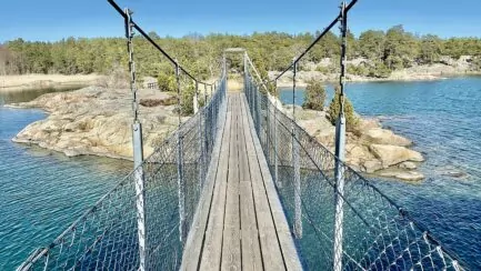 Stendörren nature reserve - with suspension bridges between islands


Solan says:
Yes, we have walked there. But then there were only dots to follow, not at all as it looks now. But both crevice, rocks and roots are recognised! 😉
We have friends in the neighbourhood, so almost every year we are at the High Coast. Tip, go to Rotsidan, worth a visit. If you haven't moved on...😊 🚐
31 May 2023 - 13:59
Helena says:
I can imagine that it has evolved! Signs, walkways and other things looked very new! Glad you were here! And thanks for the tips! 🙂
31 May 2023 - 20:47
bmlarsreseblogg says:
We also walked to Slåttdalsskrevan and first thought we had arrived when we came to the first one (with the stone hanging over). Then there was no trip up the mountain because when we sat above the crevice and had coffee, the thunder began to rumble and the rain dripped. We had to hurry back the same way we came and managed reasonably well so the view is still there if we return sometime. Surely it is a cool nature!
31 May 2023 - 17:36
Helena says:
Isn't it easy to think that the first "little" crevice is the real thing? They should put up a sign there, you might think, so you understand that you should continue! Thunder does not sound so cosy ... The view was fantastic, so you have something to return to!!! 🙂
31 May 2023 - 20:48
BP says:
What an adventure! Incredibly exciting and very impressive. How lucky you were that you were able to go there before the ban came into force. Then I wonder why you were advised to "Keep your distance. Don't talk. Do not stop.". I guess you followed the instructions;-)
31 May 2023 - 19:36
Helena says:
The hike here felt a bit adventurous, definitely! 🙂 And yes, even if you have great views from the entrance, it felt a bit special to go through!!! Yes, hehe, I don't know, but we did our best to follow the advice ... 😉.
31 May 2023 - 20:50
Ditte says:
Certainly it is a nice hike. We walked from the west entrance and it was a great hike (walked it four years ago at the end of July).
It's great that you were able to do the walk before it closes, but is it closed from all entrances?
Keep up the good work.
01 June 2023 - 11:24
Helena says:
Hi Ditte! It is only the passage through the crevice that will be closed. You will still be able to walk up to the crevice and look into it from the short sides, from all three entrances. All hiking trails will remain, but will be redirected so that you do not pass through the crevice.
01 June 2023 - 11:39
Lena - gott för själen says:
So beautiful up there! I've been in the neighbourhood and hiked, but never to the crevice. How lucky you were to be among the last!
Hug Lena
01 June 2023 - 20:40
JoY says:
How lucky you were to go through there, it would have been a bit tricky otherwise. Beautiful view you also got from the top.
04 June 2023 - 20:58