



Writer: Helena Bergström
Updated: October 2026 | Skuleberget is one of the High Coast's great nature experiences. Here you can hike, climb Via Ferrata or take the cable car to the top – we chose our legs. Join us on our hike up Skuleberget and get our best tips for your own visit.
 Tweet
 Share
 Share
 Pin
 Share
 Share
Table of contents
Visiting Skuleberget
We hiked up Skuleberget via Södra Bergsstigen and then chose a different route back down. It was considerably harder than we might have imagined, but also one of our finest nature experiences in the High Coast. Here we tell you how the hike was for us, which trails there are and what is good to know before you give up.
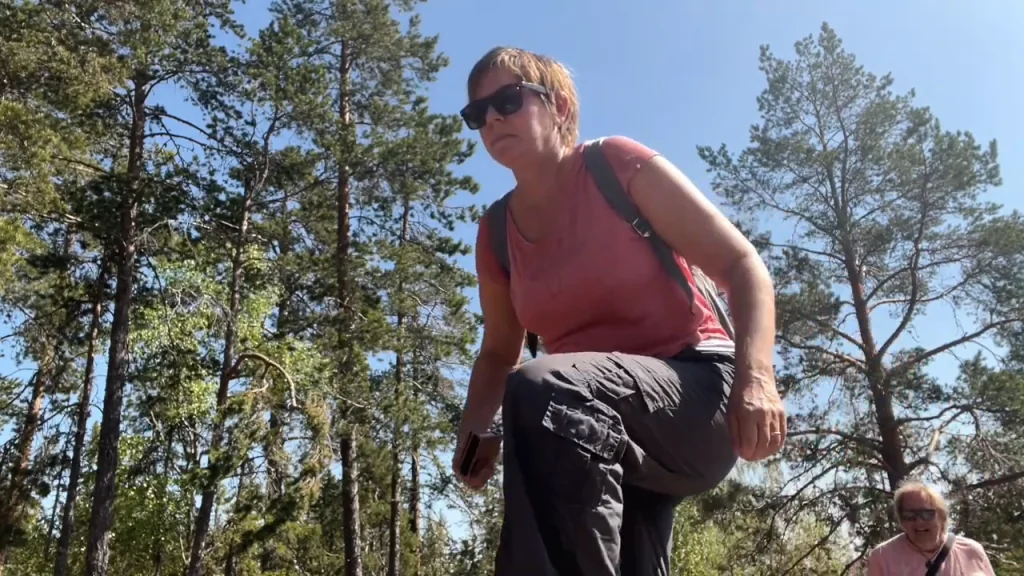
Helena and Peter from FREEDOMtravel.se on their way up Skuleberget
Skuleberget in the High Coast
Skuleberget is located just north of Docksta in Ångermanland and is part of the High Coast World Heritage Site. The mountain is 295 meters high, but perhaps the most fascinating thing is the traces of the enormous land uplift that has shaped the entire area.
When the ice sheet melted around 10,500 years ago, the sea level was 286 meters higher on Skuleberget than it is today. Only a small part of the peak was then above the sea. The old coastline is the highest measured in Sweden and is one of the reasons why Skuleberget is such a good place to understand the High Coast World Heritage Site. At the foot of the mountain is Naturum Höga Kusten, and several of the hiking trails to the peak start from here.

Best things to do on Skuleberget
Most people come here for the nature and the views, but there are several ways to experience the mountain. Our best tips are to:
- Hike to the top of Skuleberget
- Enjoy the view of the High Coast
- Walk the Kalottstigen trail around the peak.
- Visit the King's Cave via the Cave Path
- Learn more about the world heritage at Naturum Höga Kusten
- Climb Via Ferrata if you want more adventure
- Take the cable car up if you don't want to or can't hike all the way.
We chose the hike. And in retrospect, we're glad we did, because the journey up was just as much a part of the experience as the summit.
Hiking Skuleberget – which route should you choose?
There are several routes up Skuleberget and the difference between them is quite large. Shortest definitely does not mean easiest here.
Cave path – 600 meters: The shortest but also the steepest and most demanding trail. There are cliffs, stairs and railings here and the trail passes Kungsgrottan. It is recommended primarily for hiking uphill and should be avoided when the mountain is wet.
Southern Mountain Path – 2.5 kilometers: A longer and less steep route that for most people is an easier alternative than the Cave Path. Expect about 1–1.5 hours up. This was the route we chose.
High Coastal Trail – 2.7 kilometers: Goes up the eastern and northern sides of the mountain. The terrain is rocky and hilly but the trail runs more in the shade, which can be nice on hot days.

From the west side there is also the Västra Bergsstigen and the Linbanestigen. Up at the top is the 900-meter-long Kalottstigen, which runs as a circular loop and offers views in several directions.
The signage may look different
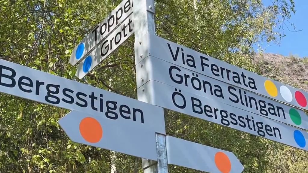
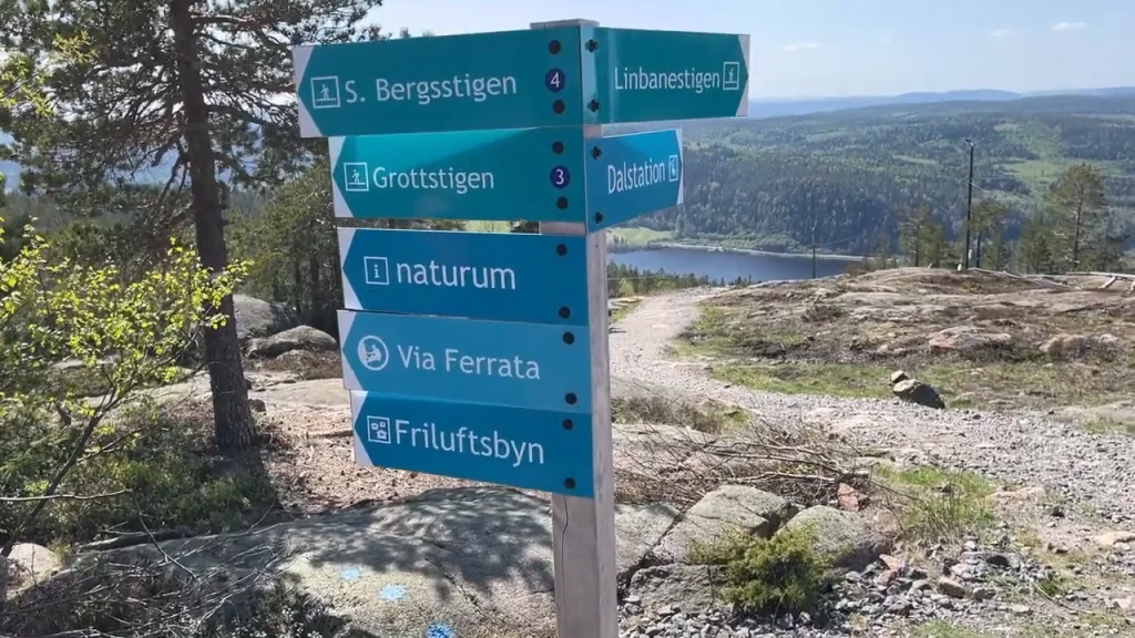
When we did our hike in 2023, we were met by signs for Bergsstigen, Gröna Slingan, Ö Bergsstigen, Grottstigen and Via Ferrata, among other things. Trails and names may change, so use the current signage and map when you are there.
Our hike up Skuleberget
For us, there weren't really many options. We were here during the pre-season and the cable car hadn't opened yet. The Via Ferrata also went away pretty quickly because I, Helena, am afraid of heights. So it had to be hiking.
We chose the Södra Bergsstigen because it was recommended as a good alternative to the steeper trails. On paper, 2.5 kilometers doesn't sound very dramatic, but it's one thing to read a distance on a sign and quite another to walk it up a mountain.

Södra Bergsstigen – our way up
The path is nice and varied, but we wouldn't describe it as an easy walk. In several places it goes over rocks and roots and the gradient meant we had to work hard.
So we took it easy. Every now and then we sat on a rock, drank water and caught our breath. And it wasn't really that bad, because the higher we got, the more the landscape opened up between the trees. This is the kind of hike where you don't need to be in a hurry. The journey is the destination, and the views along the way are part of the whole experience.


How hard is it to hike up Skuleberget?
The official description states the Södra Bergsstigen as less steep than the Grottstigen, but that doesn't mean it's easy. The County Administrative Board describes all paths up the mountain as demanding and recommends plenty of time and water.
For us, the hike took about 1.5 hours at a leisurely pace. We found it relatively demanding, but absolutely doable if you are normally mobile, have good shoes, and let the hike take its time.

Finally at the top of Skuleberget
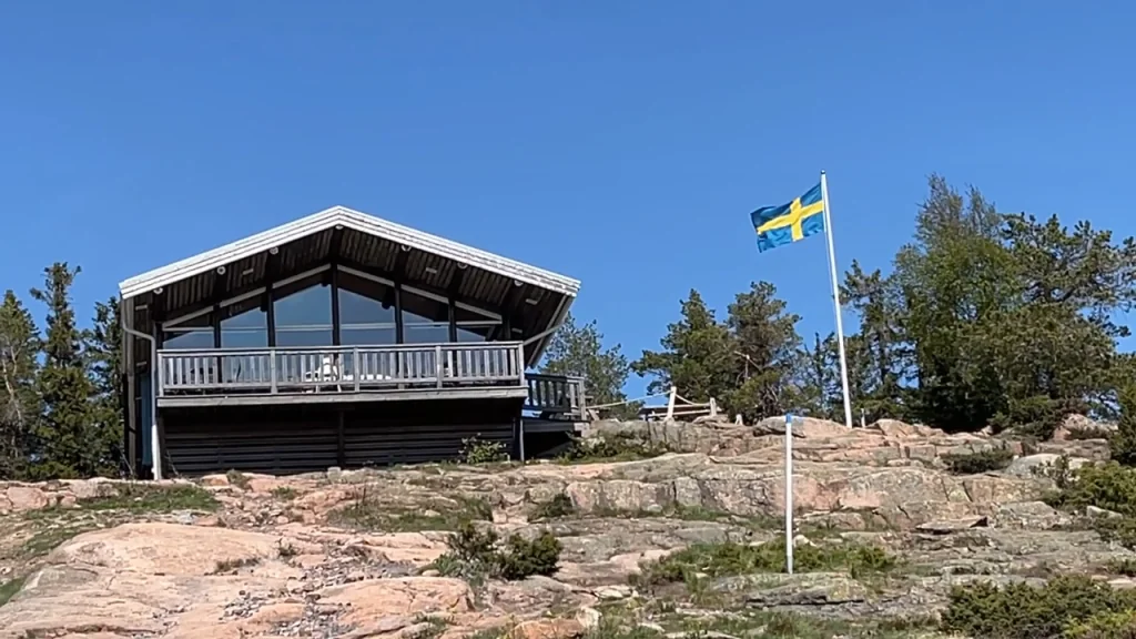
After all the pedaling uphill, something that is always so wonderful during a hike happened: suddenly we saw Toppstugan in front of us. We were there! It's hard to beat the feeling when your legs are tired and the goal you've been working towards suddenly stands there. We settled down and enjoyed both the view and the fact that we had actually made it all the way up.
The top cabin hadn't opened for the season yet, so we didn't get to try the famous waffles. We did have water and chocolate biscuits in our backpacks, though. And at that moment, they tasted absolutely delicious.
The view from the top
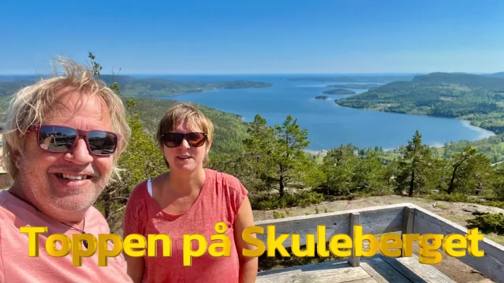
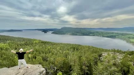
There are nice views already during the hike, but up on Skuleberget the landscape really opens up. In front of us were the forests, mountains, sea and islands of the High Coast. It is only up here that you really understand why the area is called the High Coast.
Kalottstigen – around the top of Skuleberget
If you still have energy left, you can continue on Kalottstigen, a circular loop around 900 meters long at the top. The trail follows the area around the highest old coastline and offers views in all directions. The official destination guide classifies the round as medium difficulty and states up to about an hour. So it's a good way to get even more out of the top before you start the hike back down.

King's Cave and the Cave Path
If you want a much steeper adventure, the Cave Path is the shortest route between Naturum and the summit. It is only about 600 meters long, but don't let the short distance fool you.
Here you will find cliffs, stairs and railings and the trail is considerably more demanding than the Södra Bergsstigen. On the way you can make a detour to Kungsgrottan, which was probably formed by ice and water when the ocean waves once hit the mountainside. The cave has also been called Rövargrottan and archaeological findings show that people used it already several thousand years ago.
We did not walk the Cave Trail during our hike and therefore cannot tell you how it feels to walk. However, for those who choose it, it is important to know that the County Administrative Board advises against the trail in wet weather and recommends that it be used uphill rather than downhill.

Via Ferrata on Skuleberget
If you want to do much more than just hike, there is a Via Ferrata on the steep east side of Skuleberget. There are four fixed cable routes in the approximately 250-meter-high mountain slope. It was nothing for Helena with her fear of heights, so we will leave that experience to braver visitors. But it certainly looked spectacular.
Cable car to the top of Skuleberget
You don't have to hike or climb to get to the top. On the west side of the mountain is the Skuleberget cable car, which is normally in operation during the summer season. From the upper station you can continue to Toppstugan and the viewpoints, among other places.
A popular option is to combine: take the cable car in one direction and use your legs in the other. We could have imagined that option. But since the cable car had not opened for the season when we were here, our legs had to do all the work.

Our hike down Skuleberget
When we had finished resting at the top, there was only one small problem left. We were going down too. We could have gone back the same way, but it felt more fun to see a different part of the mountain. We therefore chose a different route down, which at the time of our visit was signposted as Östra Bergsstigen.
At first it looked almost ridiculously easy. There were nice wooden bridges and lovely viewpoints and we started to think that the way down would be much easier. It wasn't.


Snow, mud, rocks and roots
As the trail continued into the forest, the terrain changed. It was May and there was still snow in some places. Other parts were muddy and further down there were again plenty of rocks, roots and a steep incline. Of course, we eventually made it down. Tired, a little sore – and very happy.


Naturum Höga Kusten – start here
At the foot of Skuleberget is Naturum Höga Kusten. Here you will find exhibitions about the World Heritage Site, land uplift, Skuleskogen National Park and Skuleberget, as well as information, maps and staff who can answer questions about the area.
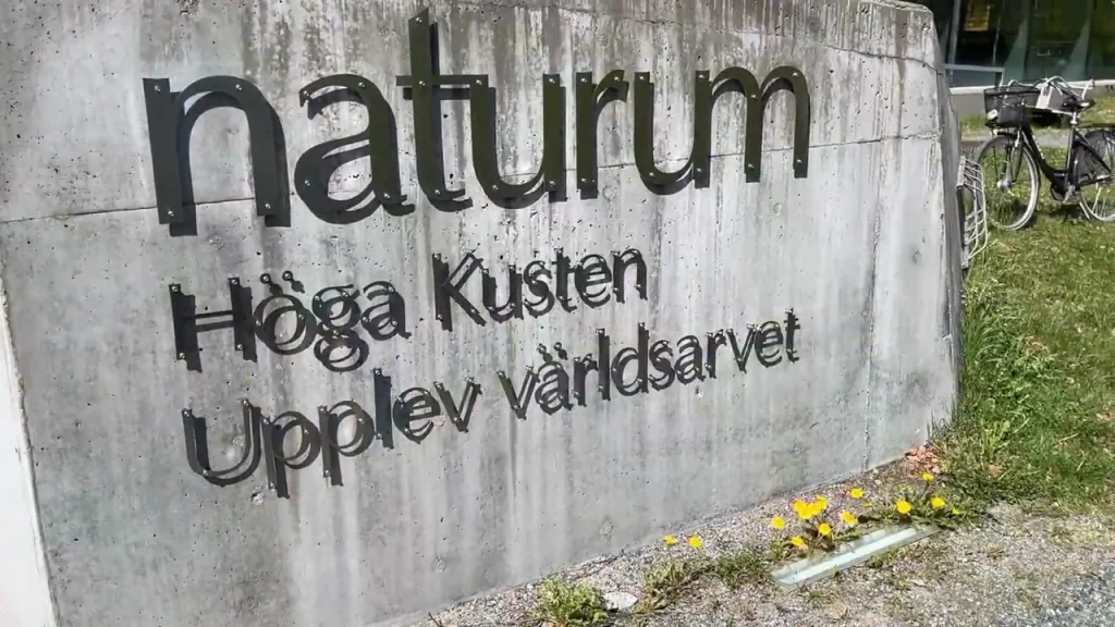
We stopped in before our hike and thought it was an interesting stop. Above all, it makes it easier to understand the landscape when you have the history of the land uplift explained – and then you yourself stand 286 meters above the old highest coastline.

Skuleberget Havscamping – this is where we stayed
During our visit, we stayed with our camper at Skuleberget Havscamping near Veåsand. For us, it worked well as a base because we could walk to Naturum and Skuleberget and also had other hikes and nature experiences very close by.

It was also from here that we later set off towards Getsvedjeberget and the spectacular cliff that is usually called the High Coast Pulpit.

More hikes near Skuleberget
Skuleberget doesn't have to be the only hike if you're staying a few days. From Skuleberget Havscamping you can head towards Getsvedjeberget, and just a few kilometers away is Skuleskogen National Park.
READ MORE: Getsvedjeberget and the Pulpit – our hike
READ MORE: Slåttdalsskrevan - our full-day hike in the Skuleskogen National Park
The three hikes are very different. Skuleberget is a lot about the climb itself and the view from the top, Getsvedjeberget gives great rewards for a relatively short hike, and the trip to Slåttdalsskrevan was a significantly longer, full-day experience for us.

When is the best time to hike Skuleberget?
The summer months are the easiest time for most people, but Skuleberget can be visited all year round. During the winter, the parking lot at Naturum is cleared of snow, but the hike can be significantly more demanding and if it is slippery, crampons may be needed.
We hiked in May. The advantage was the calm and the spring feeling, but higher up the mountain there was still snow and wet areas. In addition, not all seasonal services had opened yet.
Further down, the path also became quite challenging, with lots of rocks and roots, and sometimes quite a steep slope. But of course we got down! After the hike we were tired and satisfied, after a wonderful day.
Film from Skuleberget
You can also watch a film from Skuleberget, Predikstolen, Slåttdalsskrevan and Skuleberget Havscamping.
Our best tips for the hike
- Choose a route according to your ability – the 600-meter Cave Trail can be significantly tougher than the 2.5-kilometer Södra Bergsstigen Trail.
- Wear good shoes with good grip.
- Bring water even if the hike doesn't look long on the map.
- Don't stress out – stop and enjoy the views along the way.
- Check weather and current conditions before choosing a route.
- If you want to see more, add Kalottstigen when you are at the top.
- Please start at Naturum for information and an up-to-date map.
- Don't just photograph the view – the hike itself is half the experience.
Facts about Skuleberget
Location: At Docksta in Kramfors municipality, Ångermanland
Protection: Skulebergets Nature Reserve
Size of the nature reserve: 224 hectares
Highest coastline: 286 meters above present-day sea level
Southern Mountain Path: about 2.5 km
Cave path: about 600 meters
The High Coastal Trail to the top: about 2.7 km
Calottstigen: about 900 meters
Naturum: At the eastern foot of the mountain
To the top: Hiking, Via Ferrata or cable car during its opening hours.
Frequently asked questions about Skuleberget
How long does it take to walk up Skuleberget?
It depends on which route you choose. The Södra Bergsstigen and Höga Kustenleden normally take around 1–1.5 hours to climb, while the short but significantly steeper Grottstigen is listed at around 30–40 minutes. For us, the Södra Bergsstigen took around 1.5 hours at a leisurely pace.
What is the easiest trail up Skuleberget?
The Södra Bergsstigen is longer but less steep than the Grottstigen and is therefore more suitable for many visitors. The Höga Kustenleden is also less steep than the Grottstigen but runs through rocky and hilly terrain. Neither trail should be considered a regular walk.
Can you drive up Skuleberget?
No. You can park at Naturum and then continue on foot. If you want to avoid the hike, there is a cable car from the west side of the mountain when it is in operation.
Can you take the cable car up to Skuleberget?
Yes, during cable car opening hours it is possible to go up from the west side of the mountain. Always check the current opening hours before visiting as they vary with the season.
Can you hike Skuleberget with children?
It depends on the children's age, experience and which route you choose. The Cave Path is very steep and the County Administrative Board advises against it with small children. The Southern Mountain Path is less steep but still a real mountain hike.
Are dogs allowed on Skuleberget?
Dogs are allowed but must be on a leash in the nature reserve. The cave path is unsuitable for dogs as the metal stairs can pose a risk to their paws.
What is at the top of Skuleberget?
At the top there is Toppstugan, viewpoints and Kalottstigen, the approximately 900-meter-long circular path around the top.
More to see and do in the neighbourhood
Of course, there is even more to see and do near Skuleberget in the High Coast. For example, it is interesting to visit Mannaminne open-air museum, Hemsö Fortress and the petroglyphs at Nämforsen. Also check out all our tips on experiences and things to do. to do in the High Coast. Below you will find even more tips on things to see and do in Ångermanland.
You might also like:
 Getsvedjeberget – hike to the pulpit on the High Coast
 Things to do in the High Coast - 25 sights and experiences
 Slåttdalsskrevan - hiking in the Skuleskogen national park




 What to do in Örnsköldsvik - 15 sights and experiences



 English (UK)
 Svenska
Solan says:
Good thing you were on a mission before school ends. We rested on the way home the year before last, packed at Skuluberget!.
But great for the tourism industry that has really developed in the area ⭐👍.
In the past, Docksta was best known for its shoe manufacturing...
04 June 2023 - 8:24
Helena says:
Yes, that's the advantage of travelling during pre-season. The disadvantage is that you don't get waffles 😉.
04 June 2023 - 21:03
Lena - gott för själen says:
So fantastically beautiful up there. The campsite looked very nice! I have hiked up Skuleberget a few years ago, but I think it was from Friluftsbyn. On that particular occasion, there was some "sports operator" who had a running event up at the top cabin. They were playing loud music to get some kind of atmosphere. But no, I don't understand how you can think of playing music in such a place and not let the sounds of nature appear. But yes, they certainly had a good time.
Hug Lena
04 June 2023 - 8:33
Helena says:
Crazy with loud music up there, I would not appreciate it either. Agree that you want nature more undisturbed than that!
04 June 2023 - 21:04
BP says:
They say you always come down;-) Oh, no, you don't rest if it gets exhausting. You take mandatory photo stops, because you have a blog to run. I always think of Ama in these contexts, who was not very fond of hiking up hills to castles, among other things ...
Absolutely wonderful pictures:-)
04 June 2023 - 20:02
Helena says:
Haha, yes that can be true! But the advantage of mandatory photo stops is that you also get the chance to rest a bit 😉 And yes, I also think of Ama from time to time when we are going up to look at things, "dare to refuse the bail" 😉.
04 June 2023 - 21:06
JoY says:
We have made it to the top along the side of the mountain, Via Ferrata. Which was fun but understand that it is not to think about if you are afraid of heights. You get the view anyway and it is so beautiful.
04 June 2023 - 20:40
Helena says:
Oh how brave and tough you are!!! 🙂
04 June 2023 - 21:06